
Guide
Herceg Novi Guide
Herceg Novi landmarks in true 3D — and how to reach each by public transport (lines, nearest stops, a planner from your location).
- 6Landmarks
- Herceg NoviCity
Landmarks · 6
 3D Kanli KulaA 16th-century Ottoman fortress above the old town; today a summer stage with a view of the Bay of Kotor.Open guide
  3D Herceg Novi Old TownThe old core on a slope above the sea, with stairways, the Clock Tower and Belavista Square with the Church of St Michael the Archangel.Open guide
  3D Savina MonasteryAn 18th-century Orthodox monastery in the settlement of the same name east of the centre, surrounded by forest and overlooking the bay.Open guide
 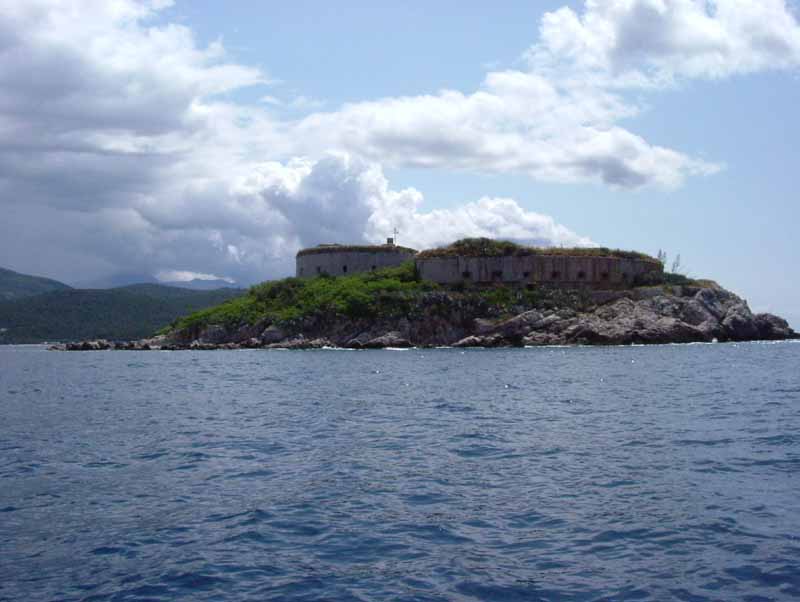 3D Mamula IslandAn island at the entrance to the Bay of Kotor with an Austro-Hungarian fortress from 1853, reachable by boat.Open guide
  3D Clock TowerA 17th-century tower with a clock, once the main gate of the old town, between Nikola Đurković Square and Belavista.Open guide
  3D Španjola FortressA hilltop fortress above the town, begun by the Spanish in 1538 and completed by the Ottomans; it offers a view of the entrance to the bay.Open guide
 Frequently asked questions
How do I reach Herceg Novi’s landmarks by public transport?
Open any landmark from the guide — its page shows the nearest stops and a planner that finds a route from your location to it, with lines, transfers and departure times based on the timetable.
Which landmarks does the guide cover?
Herceg Novi’s best-known landmarks — Kanli Kula, Herceg Novi Old Town, Savina Monastery, Mamula Island, Clock Tower — each with a 3D view of the location and directions on how to get there by public transport.
What is the 3D view of a landmark?
An interactive 3D model of the location (buildings and surroundings from OpenStreetMap data) that rotates and tilts. It is not a photo but a graphical view of the place, so you can recognise the area before you set off.
How do I plan a tour of several landmarks?
Use the Journey Planner for a public transport route to each landmark; every landmark page also lists the nearest stops with arrival estimates, so you can easily chain several points into one tour.
Photos: Wikimedia Commons (free/licensed) · 3D view: MapLibre + OpenStreetMap.