History
Ada Ciganlija was once a true river island on the Sava, known as far back as the days of Karađorđe Petrović and Prince Miloš Obrenović — in 1821 it was declared a "begluk" (state-owned estate). Its name has several interpretations: some chroniclers trace it to Celtic words for an island and waterlogged land, while others believe it comes from the Roma who lived on the island. As early as 1688 the Italians called it Isola degli Zingari, which corresponds to the present-day name.
The island was not always a place for leisure. In 1920 a prison for serious offenders was built on it, part of the District Court in Belgrade, which operated until 1954, while the building itself was demolished in 1956. It was only in 1967 that engineer Milan Pećinar, a member of SANU (the Serbian Academy of Sciences and Arts), carried out the plan by which the island was joined to the bank with an embankment and turned into a peninsula, with the idea that it would serve both as a source of drinking water and as a space for sport and recreation for the people of Belgrade.
Ada today
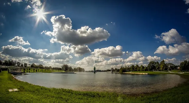
Ada Ciganlija lies just a few kilometres from the centre of Belgrade, on the southern bank of the Sava near its confluence with the Danube, in the Čukarica municipality. The peninsula is about 6.3 kilometres long, and alongside it stretches the artificial Lake Sava, roughly 4.2 kilometres long, lined by its well-known sandy beach.
Today it is the city's largest centre for sport, recreation, and entertainment, with over 50 sports courts for a range of disciplines, cycling and walking paths around the lake, as well as attractions such as a water geyser and the nearby Ada Bridge. According to available figures, Ada draws on average around four million visitors a year, and on summer weekends up to 300,000 visitors.